Tour a Hi-Res 3D Map of the Surface of Mars!
The highest-resolution global image of Mars ever created is now available for viewing in B&W by armchair astronomers. View the planet’s surface and track the paths of Mars rovers. No special 3D glasses are needed. Scan the planet’s surface from various angles and easily adjust altitude on the fly. All data in the mosaic was imaged by the Context Camera (CTX) onboard the Mars Reconnaissance Orbiter (MRO). CTX was built by Malin Space Science Systems, and the MRO by JPL.
The Bruce Murray Laboratory for Planetary Visualization completed a 5.7 terapixel mosaic of the surface of Mars rendered at 5.0 m/px. Each pixel in the mosaic is about the size of a typical parking space, providing unprecedented resolution of the Martian surface at the global scale. The mosaic covers 99.5% of Mars from 88°S to 88°N. The pixels that make up the mosaic can all be mapped back to their source data, providing full traceability for the entire mosaic.
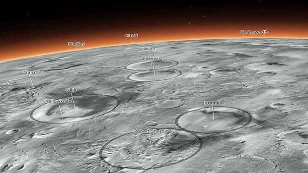
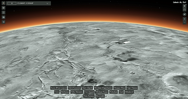
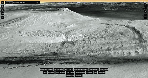
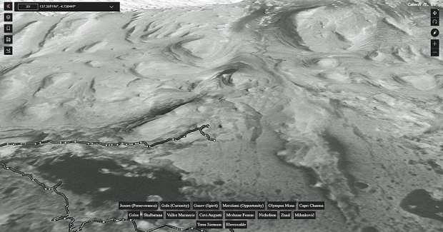
Click around the 3D map to explore different regions of the planet and zoom in to see details like dust devil tracks crisscrossing the surface. Visit regions like Gale Crater and Jezero Crater, which are being explored by NASA’s Curiosity and Perseverance rovers. Or tour Olympus Mons, the tallest volcano in the solar system, and the many impact craters marking the surface of Mars. The mosaic is available to stream over the internet and to download. For details, click here.